2. Sultan IIIb - Early Bronze II
(3000-2700/2650 BC)
 The earliest
data collected by the Italian-Palestinian Expedition so far concern period
Sultan IIIb, corresponding to the Early Bronze II.
At the beginning of
the period, the erection of the first Early Bronze Age fortifications marks the
definitive establishment of a city, which spread off as
The earliest
data collected by the Italian-Palestinian Expedition so far concern period
Sultan IIIb, corresponding to the Early Bronze II.
At the beginning of
the period, the erection of the first Early Bronze Age fortifications marks the
definitive establishment of a city, which spread off as
 a physiological
development from the previous proto-urban village of Sultan IIIa2 (Early Bronze IB).
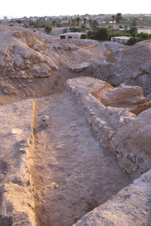
This earliest urban phase has been detected on the northern side of the site,
where excavations in Area L allowed to identify the remains of a massive
mud-brick city-wall, already excavated by Sellin and Watzinger, and plotted in
purple colour on their plan,
which is apparently the earliest urban fortification system, dating from period
Sultan IIIb, Early Bronze II.
The identification of the EB II city-wall represents one of the most prominent
results of the latest seasons in the larger perspective of studying the earliest
urban development in the Southern Levant, in which the ancient walled town of
Jericho represents an utmost example of an articulated architectural work
realized by a complex society. The EB II city-wall is made of
very distinguished
dune-yellowish mud-bricks, already noticed by previous excavators, and
characterized by their large size.
a physiological
development from the previous proto-urban village of Sultan IIIa2 (Early Bronze IB).
This earliest urban phase has been detected on the northern side of the site,
where excavations in Area L allowed to identify the remains of a massive
mud-brick city-wall, already excavated by Sellin and Watzinger, and plotted in
purple colour on their plan,
which is apparently the earliest urban fortification system, dating from period
Sultan IIIb, Early Bronze II.
The identification of the EB II city-wall represents one of the most prominent
results of the latest seasons in the larger perspective of studying the earliest
urban development in the Southern Levant, in which the ancient walled town of
Jericho represents an utmost example of an articulated architectural work
realized by a complex society. The EB II city-wall is made of
very distinguished
dune-yellowish mud-bricks, already noticed by previous excavators, and
characterized by their large size. 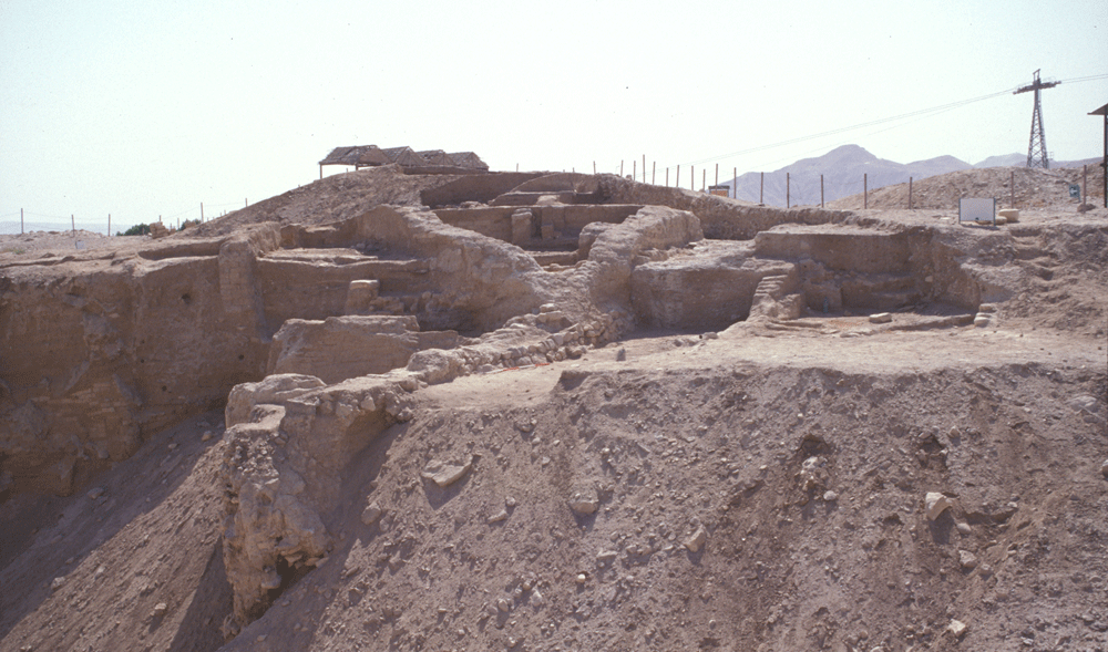 The contemporary layers in the nearby dwelling quarter were reached in Area F,
where the main feature was a street running
south-west/north-east (L.435), that
was in use
The contemporary layers in the nearby dwelling quarter were reached in Area F,
where the main feature was a street running
south-west/north-east (L.435), that
was in use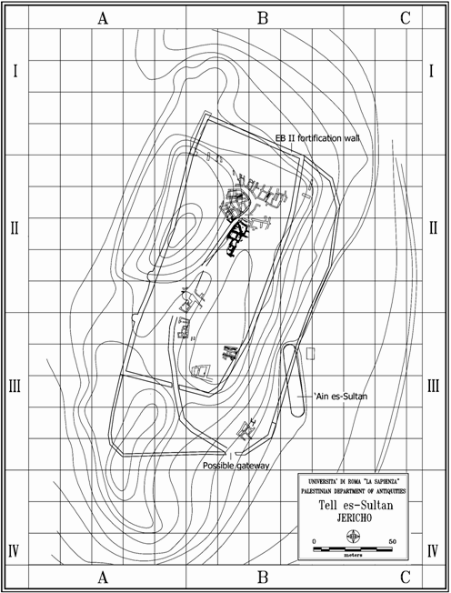 during the entire EB urban period (Sultan IIIb-IIIc) with
roughly the same outline.
On both
sides of the
street, several
units
were brought to light,
as completion of the houses already excavated by the Austro-German and the
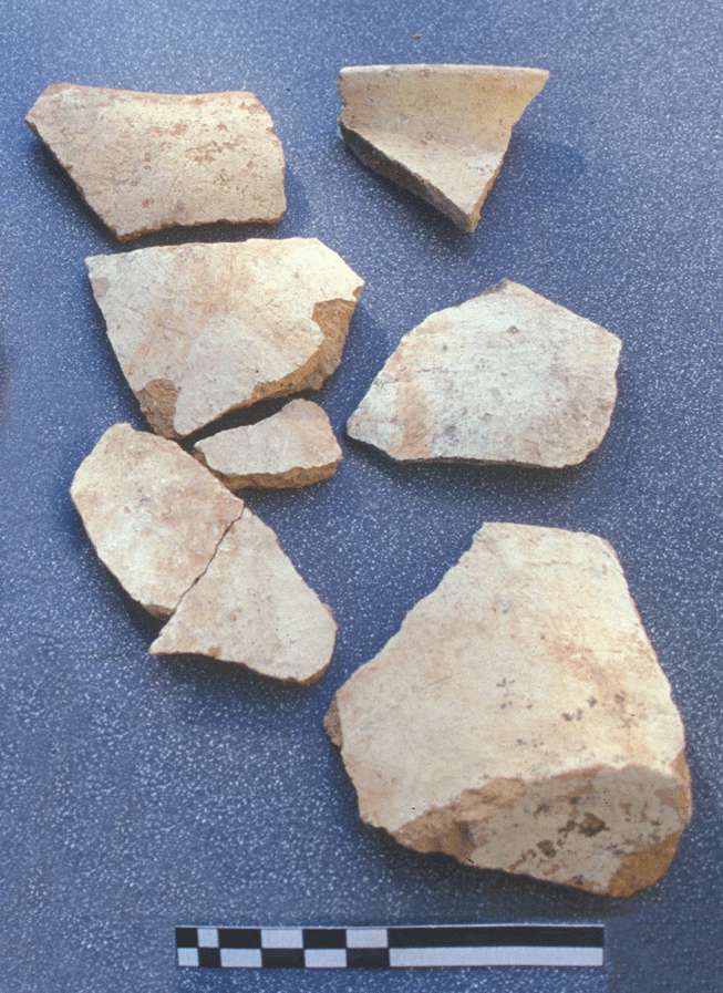
British Expeditions. In one of the rooms, Light Faced Painted Ware (Abydos
Ware) jar fragments were found .
during the entire EB urban period (Sultan IIIb-IIIc) with
roughly the same outline.
On both
sides of the
street, several
units
were brought to light,
as completion of the houses already excavated by the Austro-German and the
British Expeditions. In one of the rooms, Light Faced Painted Ware (Abydos
Ware) jar fragments were found .
On the basis of these new data, and the renewed
interpretation of previous expeditions results, the general urban layout of
Tell es-Sultan in the Early Bronze II can be
described as follows: the city was protected by massive walls, made of dune
yellowish mud-bricks; its main gate was on the south-eastern side, in front
of the Spring, and a main street crossed
it
south-north, climbing the Spring Hill from south-east and descending it
towards north-east.