6. Sultan IVa - Middle Bronze I (2000-1800
BC)
Still partially unknown socio-political changes,
occurring at the eve of the 2nd millennium BC, are
perhaps reflected in the rebirth of a fortified city at Tell es-Sultan,
which designate s the beginning
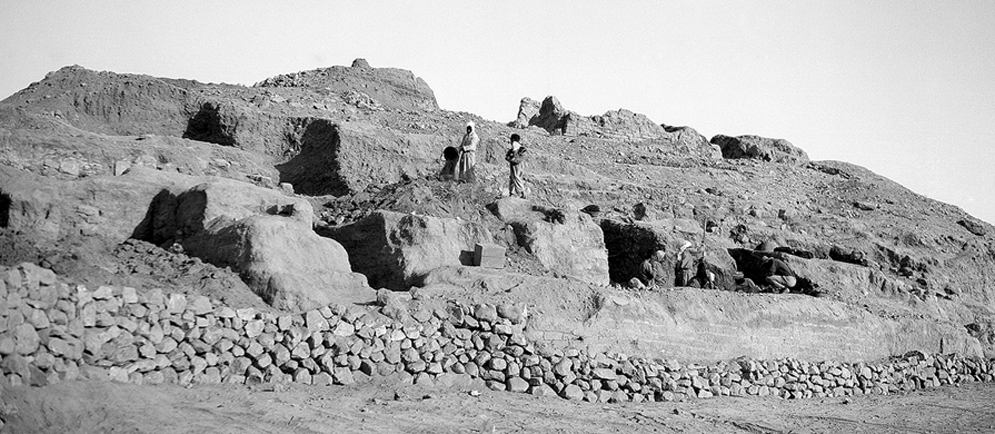 of the Middle Bronze Age (Sultan
IVa). The formative phase of the new city is a very complex and still under
investigation topic, and the Italian-Palestinian Expedition tried to
select spots suitable for its reconstruction. One is the Spring Hill,
on the top of which, in Area G, a major sustaining wall (W.633) was
identified, presumably terracing the acropolis with public
buildings, and at the bottom of which, in Area D, cleaning works
brought to light a huge mud-brick wall (W.7), just in front of the
Spring, cut by the modern road.
of the Middle Bronze Age (Sultan
IVa). The formative phase of the new city is a very complex and still under
investigation topic, and the Italian-Palestinian Expedition tried to
select spots suitable for its reconstruction. One is the Spring Hill,
on the top of which, in Area G, a major sustaining wall (W.633) was
identified, presumably terracing the acropolis with public
buildings, and at the bottom of which, in Area D, cleaning works
brought to light a huge mud-brick wall (W.7), just in front of the
Spring, cut by the modern road.
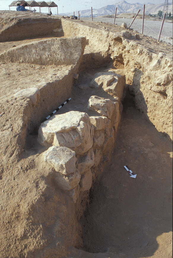
This
wall, at its southern end, may be identified with the structure
already excavated by J. Garstang protruding from the East Tower (a
massive defensive building possibly connected to a gate),
while, at its northern end, was excavated by K.M. Kenyon (HCJ+HCP),
who also identified a rectangular tower (HBL+HBJ+HBK) connected with
it.
A sounding below the foundations of Wall W.7 proved that it and the
related tower can be attributed to Sultan IVa.
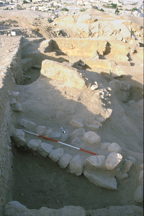
Excavations in Area A, on the southern flank of the tell,
brought about the discovery of Building A1, a huge building with a
rectangular tower, which was erected during Sultan IVa, and kept in
use during Sultan IVb (see below).
The building technique of Tower A1, its orientation and its function
are very similar to those of Garstang�s East Tower, suggesting that
both monuments belonged to the same early Middle Bronze Age
fortification system of Tell es-Sultan, consisting of a solid
mud-brick wall 2 m thick, as like as in many other Palestinian
sites,
with various buttresses and towers.
On the top of the hill, in Area G, terrace-wall
W.633, made of big fieldstones, sustained a public building (the
north-western counterpart of this terrace wall was identified with
W.420 in Area F), largely disappeared due to intense disturbing
activities in the Byzantine period. Underneath this building,
the southern wing of which was identified by Sellin,
there was a group of built-up tombs with relatively wealthy funerary
assemblages, which, for their location and general characteristics
may be interpreted as princely burials beneath the palace.
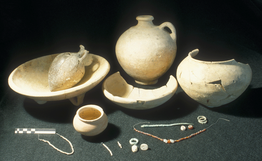
One of these tombs (D.641) was discovered by the Italian-Palestinian
Expedition. In the tomb two flexed bodies were buried, apparently an
adult and a female about 12-14 years old, with two sacrificed kid
animals (a gazelle and a goat) and six vessels of which at least one
contained food offerings.
 The young lady wore a pair of bronze double
earrings, a necklace of carnelian and rock crystal beads, a bronze
pin for closing the tunic on the left shoulder, some chains of frit
beads and a digital bronze ring with a steatite scarab of local
manufacture, while another scarab was found under the left side of
the head.
The young lady wore a pair of bronze double
earrings, a necklace of carnelian and rock crystal beads, a bronze
pin for closing the tunic on the left shoulder, some chains of frit
beads and a digital bronze ring with a steatite scarab of local
manufacture, while another scarab was found under the left side of
the head.
In Area F, terrace-wall W.420 , made of big
fieldstones and oriented as W.633, was identified supporting the
uppermost area of the site, where a major building was erected, a
wall of which was excavated in 1999 (W.431).
In respect of the Early Bronze Age city, that of
the beginning of Middle Bronze Age was characterized by the
enucleation of a major dominant urban area on top of the Spring
Hill, extending towards north with a rectangular plan around 100 x
50 m, where the palace (and perhaps also the main city-temple) was
located,
and by a completely new fortification system built at the bottom of
the tell, and consisting of a solid mud-brick wall with
towers at regular intervals (see below).