Supported by the Italian Ministry of Foreign Affairs

Tell es-Sultan/Jericho

Season 2009
TELL ES-SULTAN/JERICHO - ARIHA (Palestinian National Authority)
Preliminary Report on the 5th Season of Archaeological Investigations
and Restorations at Tell es-Sultan/Jericho by Rome "La Sapienza" University
and the Palestinian MOTA-DACH - March-April 2009
1. Introduction: the Fifth Season (2009) at Tell es-Sultan
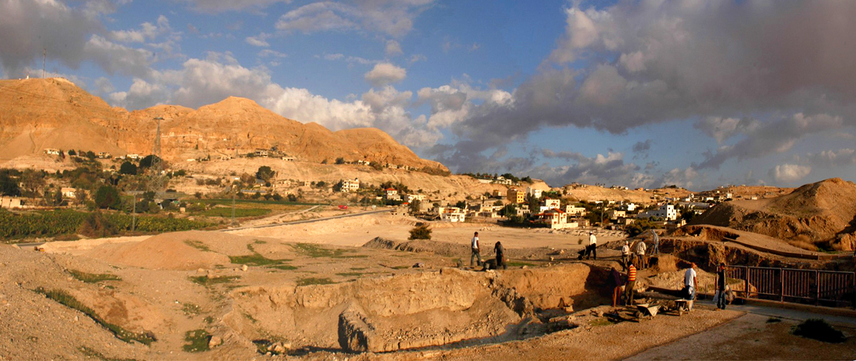
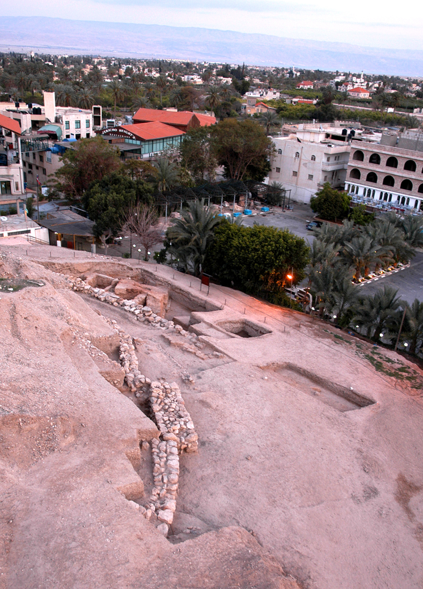
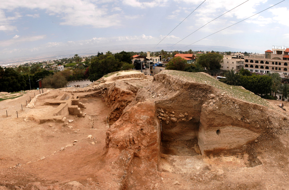
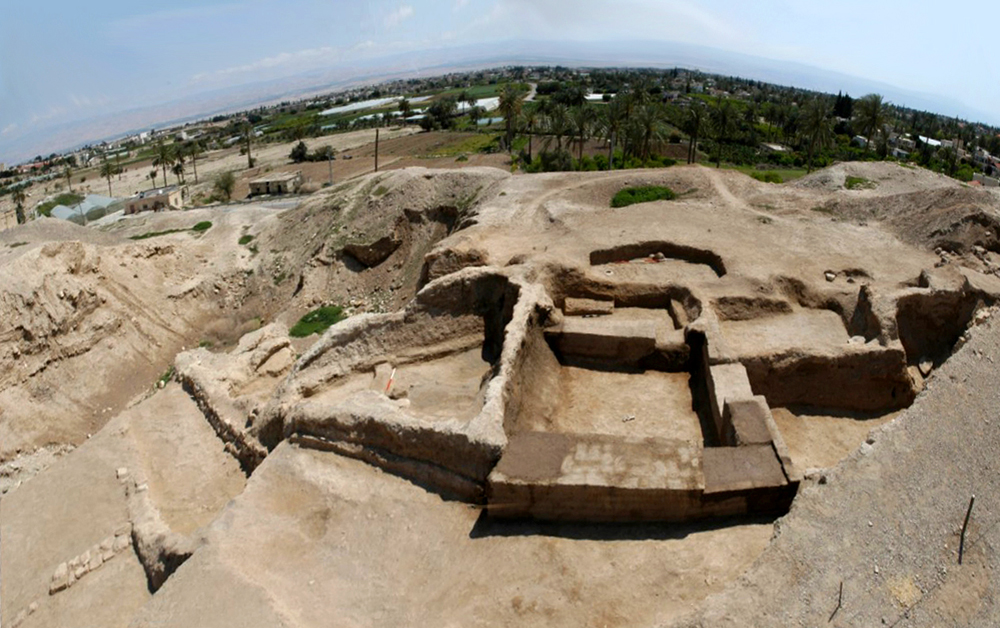
The fifth season of archaeological activities at Tell es-Sultan/ancient Jericho, one of the major archaeological sites of Palestine (Garstang - Garstang 1948; Kenyon 1957; 1981; 1993; Nigro 1999; 2005; Nigro - Taha eds 2006), was carried out under the auspices of the Department of Antiquities and Culture Heritage - Ministry of Tourism and Antiquities of the Palestinian National Authority between March 3rd and April 2nd 2009, and was focused on excavations and restorations of the Bronze Age superimposed cities and related fortifications in five Areas of previous excavations (Areas A, B & B-West, E, F; Marchetti - Nigro eds 1998; 2000; Marchetti - Nigro - Taha 2000; Marchetti - Nigro - Yasin - Ghayada 2000), plus a new opened Area at Kenyon's Trench I (Area Q; fig. 1), together with an overall rehabilitation of the tourist paths and explanatory panels on the site (figs. 2-3), and restoration interventions focused on some major monuments of the Bronze Age cities (figs. 4-5).
Works on the site were directed by Prof. Lorenzo Nigro and Dr Hamdan Taha (Director General of MOTA-DACH), with the vice-direction of Dr Maura Sala (Rome "La Sapienza" University) and Jehad Yasine (MOTA-DACH).
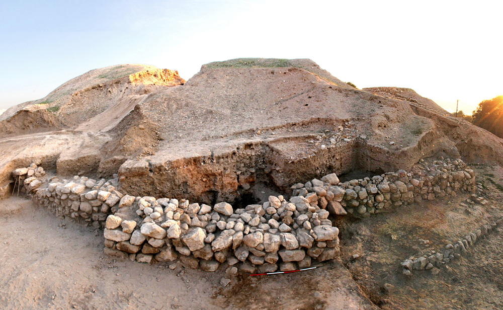
2. Area A: the MB I-II Tower, the adjoined MB II houses, and the MB III Cyclopean Wall
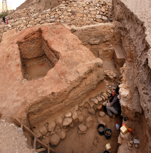
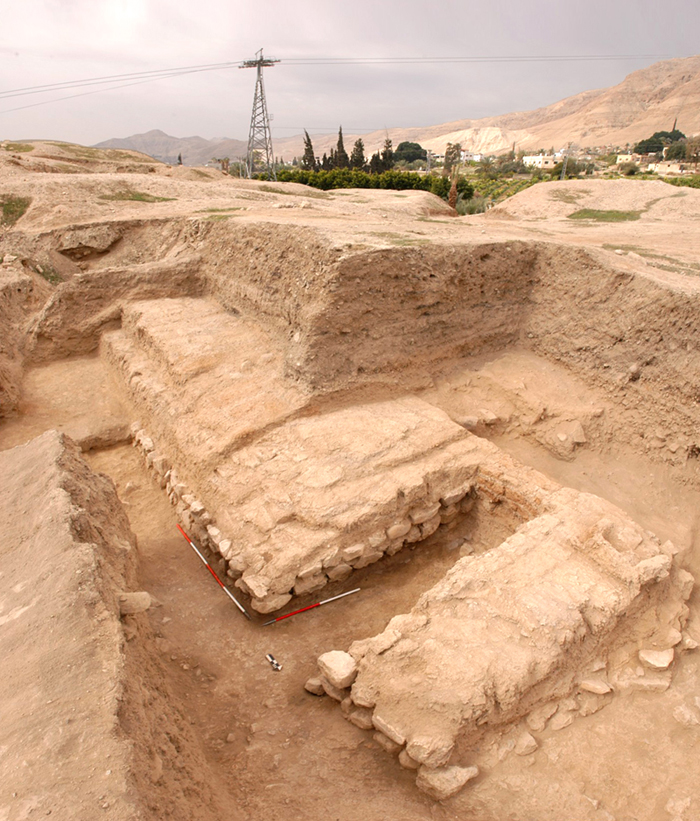
Excavations and restorations in Area A were focused on a major building discovered in previous seasons of the Italian-Palestinian Expedition (1997-2000), called Tower A1 (Marchetti - Nigro eds 1998, 124-135; 2000, 199-207), in order to further clarify its architecture, function, stratigraphy and chronology (fig. 5). Moreover, another portion of the MB II (1750-1650 BC) houses arisen against the eastern side of the Tower (Marchetti - Nigro eds 2000, 207-216; Nigro - Taha eds 2006, 33), and a further stretch westwards of the MB III (1650-1550 BC) Cyclopean Wall (W.4; Marchetti - Nigro eds 1998, 135-154; 2000, 217-218; Nigro - Taha eds 2006, 34-35), with its foundations trench and the related rampart rubble filling, were brought to light.
As regards Tower A1, its foundation wall was exposed, completing the excavation of the destruction layer in the open space west of the structure, and reaching the original floor connected with this building. The monumental building was erected over a 2 m thick foundations, consisting of big blocks laid as orthostates on their western visible face (fig. 6). Small and medium size stones protected the base of the superstructure, made of regular reddish-brown mud-bricks tied up by a grey mortar, and preserved up to 2.4 m. In the blind room inside the Tower the original floor was reached exposing the upper course of foundations stone walls and a protruding basement on the western side, the platform supporting a wooden staircase, which allowed to descend into the room from above.
Ceramic material from the collapse layer in the courtyard west of Tower A1 (fig. 7) confirmed a dating towards the end of MB I (in the last quarter of the 19th century BC) for the final destruction of the earliest phase of use of this structure, which with several repairs was maintained in use in the following period.
In a second stage of use, at the beginning of MB II (1800-1750 BC), a stone wall of three/four courses was adjoined to the foundation of the Tower, apparently with the aim of protecting it on the western, southern and eastern sides, while a perpendicular wall was added to the north in order to strengthen the whole structure. South and east of the Tower a series of private houses were built against the bounding wall during the whole MB II; one of these houses gave back noteworthy pottery material and showed a collapsed tannur and a carbonized wooden plate on its latest floor.
Area A was expanded to the west bringing to light a further stretch of Cyclopean Wall W.4, a huge structure supporting the MB III (1650-1550 BC) rampart. Excavations confirmed that such a monumental wall was built within its foundation trench by filling progressively it for laying superimposed courses of big limestone boulders, and it was never intended to be seen, being fully buried by the rubble filling of MB III rampart.
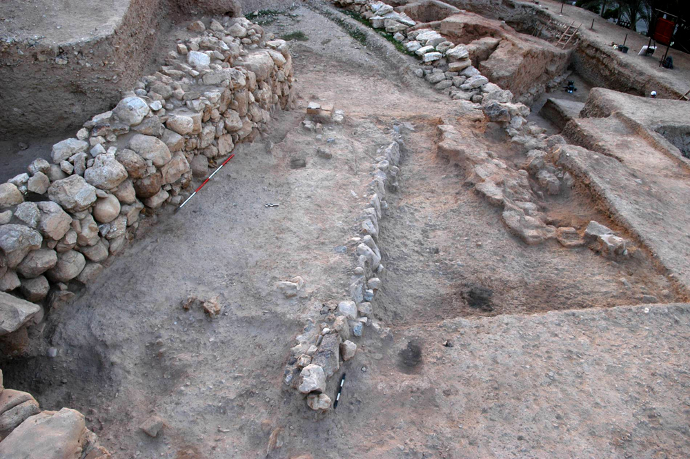
3. Area E: MB II stone wall, buttress, destruction layer and superimposed structures
For the sake of clearness, Area E is treated following Area A, with which it has a structural and stratigraphical contiguity represented by Cyclopean Wall W.4, which separates the two flanking fields of excavation (fig. 8).
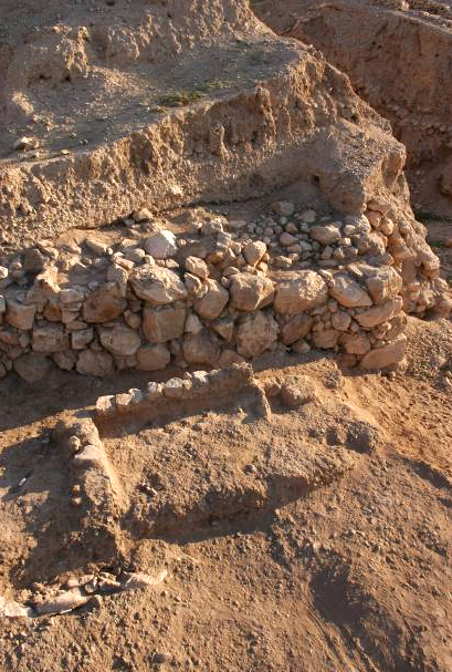
Area E lies at the south-western foot of the tell (Marchetti - Nigro eds 2000, 181-192; Nigro - Taha eds 2006, 29-30), and it was considerably enlarged by removing dumps from previous excavations (Garstang's and Kenyon's dumps). The main structure brought to light is a stone wall, made of big boulders irregularly set in at least six superimposed courses (1.6-2.0 m), built up in 4-6 m long stretches interconnected at progressive turns of the structures, which gradually curves northwards from SE to NW, following the tell morphology. Roughly at the middle of the excavated part of this wall a rectangular buttress (7.5 x 2.1 m) protrudes from its front line (fig. 9). The easternmost section of the wall, appearing at the south-western edge of Kenyon's Trench III, is a massive stone corner called Wall W.5 (fig. 11). From this structure southwards up to the northern inner side of Cyclopean Wall W.4, a 7-10 m wide layer of destruction extended, with thick accumulations of ash, charcoal and carbonized beams at the foot of the curving stone wall. Upon this layer a row of big stones retained collapsed mud-bricks and rubble fillings bordering a street running parallel to the main stone wall (fig. 10) and belonging to a later reuse of the latter towards the end of MB II (1700-1650 BC). Just in between this border wall and the main stone wall an ephemeral rectangular unit was also uncovered (fig. 12).
4. Area B & B-West: the EB III double city-wall
Archaeological activities in Area B were mainly concentrated in the complete restoration of Building B1, a multi-functional structure leaning inside the EB III main Inner Wall (W.2; Marchetti - Nigro eds 1998, 39-49; 2000, 130-138; Nigro - Taha eds 2006, 18-20), which was refurbished with traditional techniques (fig. 4).
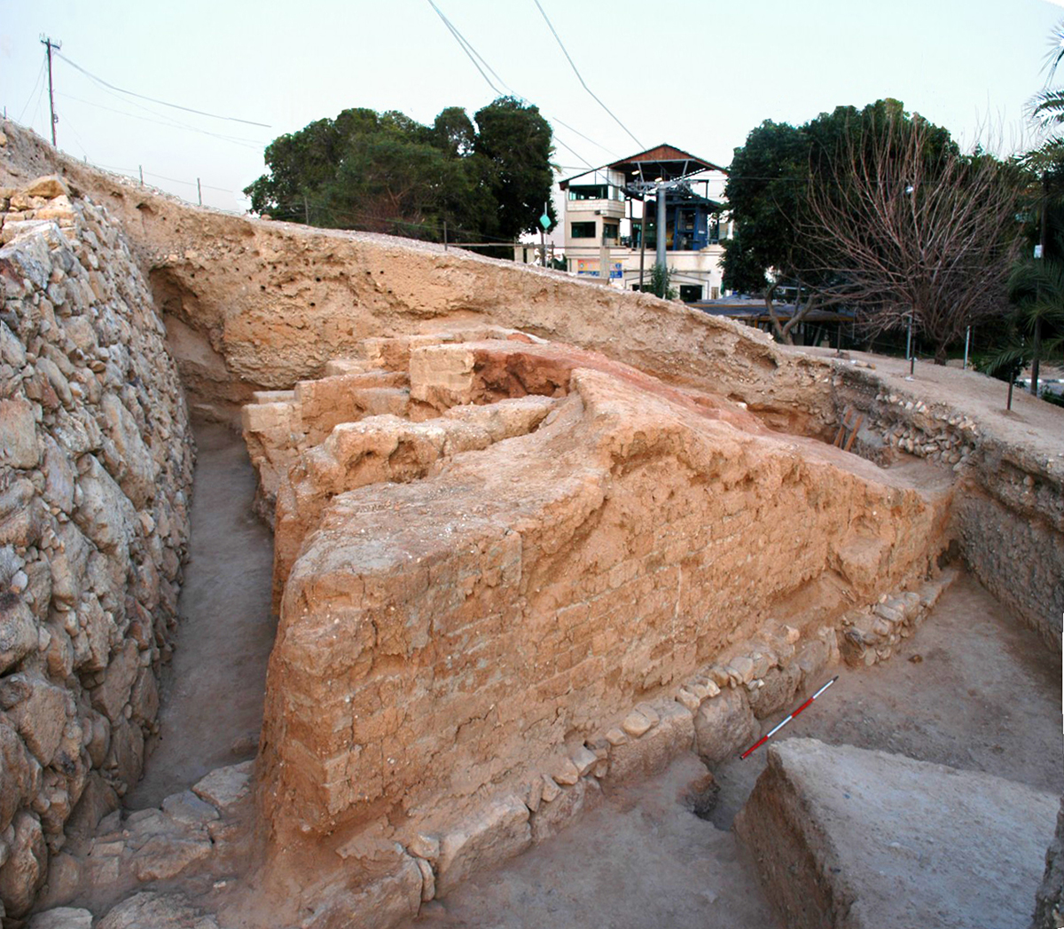
In the nearby Area B-West, extending across the EB III double line of fortifications at the southwest corner of the city (Marchetti - Nigro eds 1998, 81-94), the outer western face of the EB IIIA main Inner Wall was exposed, by digging within a blind room in between it and the Outer Wall (figs. 13-14). Such chamber was filled, in as many other along the south-western corner of the city (visible respectively on both sides of Kenyon's Trench III [Kenyon 1981, 209-213, pl. 273], and in the northern section of Garstang's site "d" [Garstang 1931, pl. I]), with clayish sandy marl, previously erroneously considered white ash by the two British archaeologists due to charcoal fragments present in it, deriving from the city-wall burnt structure (Nigro - Taha eds 2006, 9, fig. 8). The latter was found at a distinct higher elevation in Area B-West in respect of that it exhibits in Trench III, thus demonstrating that the EB III city arose on a slope from west to east where it reached the lowest elevation around the Spring. A close examination of the EB IIIA main Inner Wall showed, in the preserved section brought to light, the burnt remains of reeds and wooden beams inserted into the massive mud-brick structure (fig. 15), up to 4.0 m wide and 8.0 m high, so to ensure air circulation for humidity absorbing, and structural linkage of the wall parts. Moreover, on the inner side of the wall, a regular row of protruding beams may indicate a balcony running along the structure.
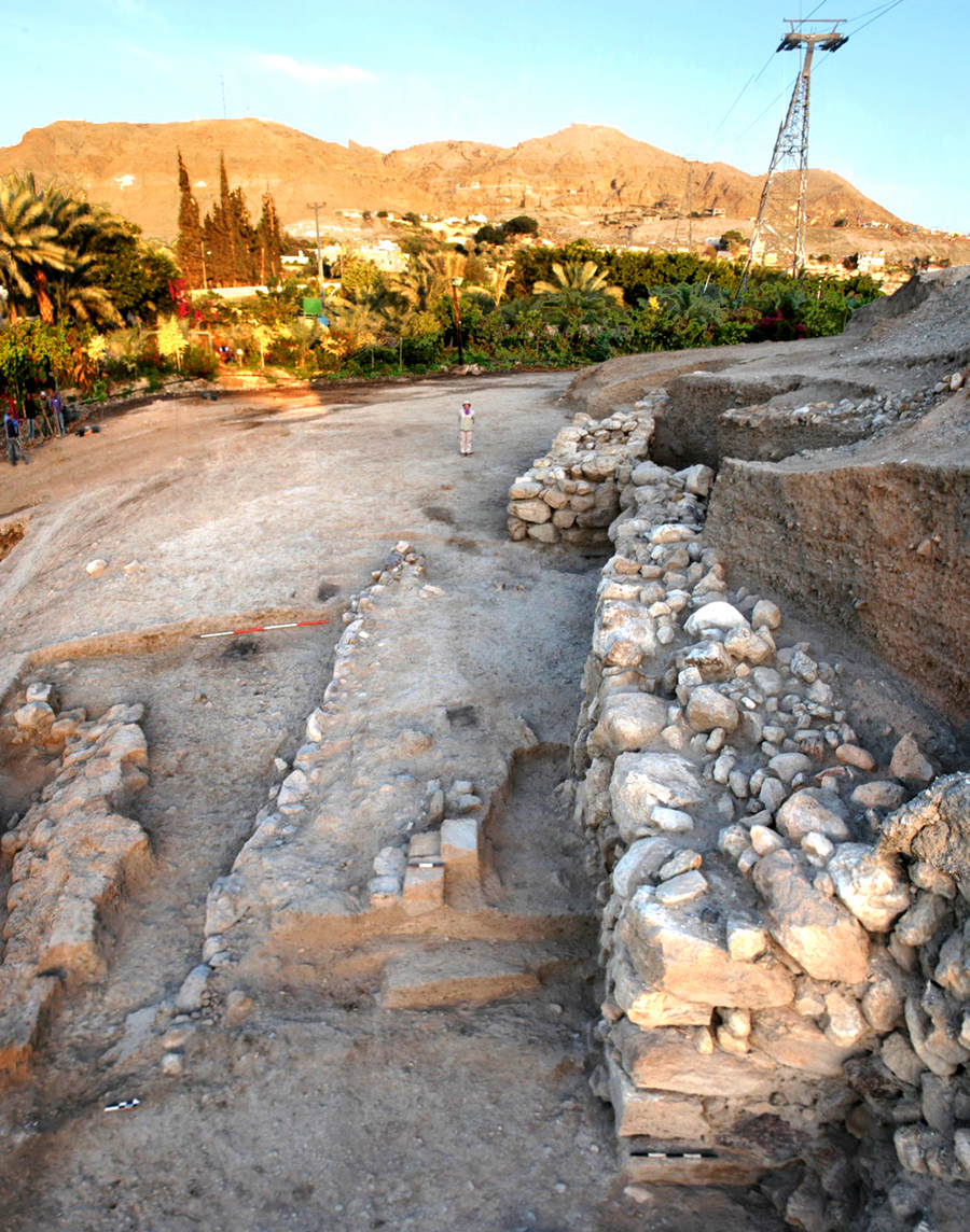
5. Area Q: the EB IIIA inner city-wall and postern
A new excavation area was opened on the top of the tell on its western side looking Jebel Quruntul, called Area Q (fig. 1), just south of Kenyon's Trench I and Site D (Kenyon 1981, 6-113). Four squares were excavated on the north-south axis ("Aq + Ar" squares columns in the grid), exposing, under a 1.5 m thick dump filling, the EB IIIA main Inner Wall, here preserved with two superimposed courses of stone foundations and two-to-four courses of mud-brick superstructure. Roughly at the middle of the 20 m-long excavated stretch of the wall, a 1.0 m-wide interruption was discovered, which proved to be a postern, successively closed on the western side (fig. 16). Such a passageway introduced in the blind room in between the Inner and Outer City-Walls, which presumably was used as storeroom and path along the fortification system.
6. Area F: the EB II-III domestic quarter
The reappraisal of exploration on the northern plateau of the tell (already excavated by previous expeditions: Sellin - Watzinger 1913, 36-38, fig. 17, pls. I-II; Garstang et al. 1935; 1936; Kenyon 1981, 309-338 [Squares EIII-IV]) was aimed at the investigation of a domestic quarter of the ancient city during the Early Bronze Age, from the earliest settlement of circular huts in EB I (3300-3000 BC; Nigro 2005) to the gradual transformation of the urban layout on both sides of a main street in EB II-III (3000-2350 BC; Marchetti - Nigro eds 2000, 15-120; Nigro - Taha eds 2006, 5-6, 10-17).
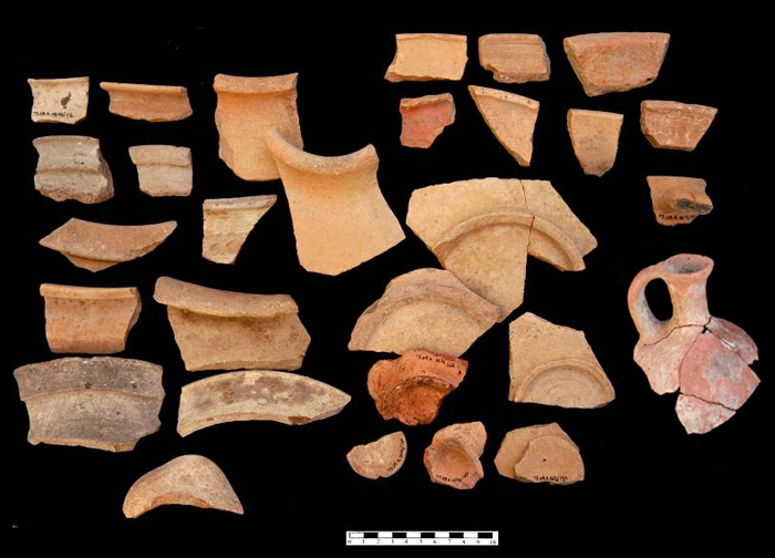
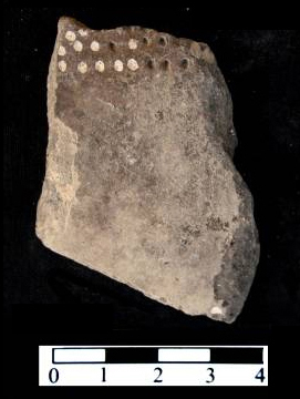
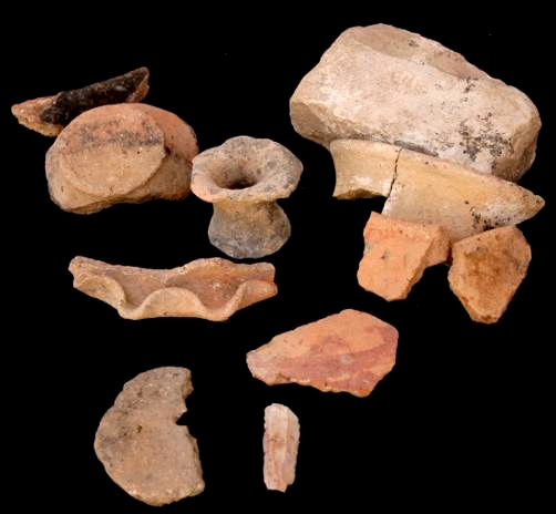
In view of tourist presentation of the Area, an overall restoration workshop with traditional mud-brick technique was carried out in House L.305, while soundings were excavated within other domestic units (fig. 17). Several food producing and storage installations were brought to light in these houses with stratified finds, illustrating typical domestic activities during EB II-III. Especially noteworthy is the finding of balance weights (fig. 18) indicating the Jerichoan shekel (7.8 grams) used for exchange of metal (gold, silver and copper) items, as well as pottery (including the renown Khirbet Kerak Ware and Abydos Ware, respectively in EB III and EB II strata; fig. 19) and flint tools (Cananean blades).
7. Kenyon's Trench I: reappraisal, restoration and musealization of prehistoric Jericho
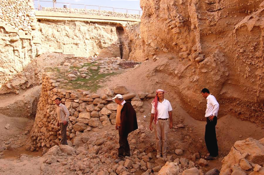
A strategic issue of the renewed expedition to Tell es-Sultan is the recover, restoration and tourist presentation of Neolithic remains in Kenyon's Trench I. Such a 15 m deep and 70 m long cut, marking the western side of the tell, belongs to the history of world archaeology and, in the meantime, revealed an imposing monument of Pre-Pottery Neolithic Period (8500-6000 BC): the PPNA stone Tower (Kenyon 1981, 18-43, pls. 5-11, 203-212). A preliminary survey of the actual situation of Trench I was carried out during this season (fig. 20), in order to plan systematic restoration works at the PPNA round Tower and selected excavations aimed at preservation and presentation of Neolithic Jericho to the public.
8. Restorations and tourist valorization: fences, paths, explanatory panels
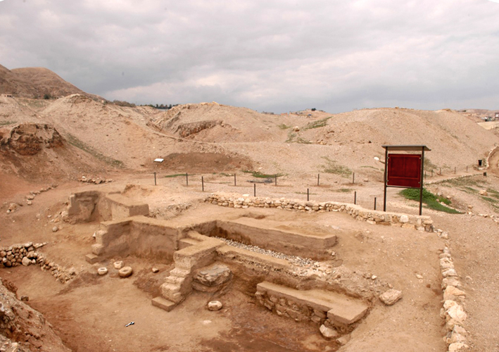
Restoration works were carried out in three Areas (A, B, and F) with the aim of preserving respectively the huge MB I-II Tower A1 in Area A, EB III Building B1 in Area B, and EB III House L.305 in Area F. As regards Tower A1, its stone foundations were restored with antique-like mortar (fig. 5), in order to provide the massive mud-brick superstructure with a solid basement (in the following years also the superstructure will be, of course, restored). Building B1 was completely refurbished with the traditional local technique for earthen architecture (fig. 4), including courses of new mud-bricks laid to protect old structures and mud plaster, which covers all walls. The same technique was adopted in Area F for House L.305 (fig. 17).
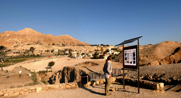
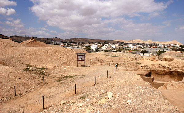
Important operations were devoted to site presentation and visit. All tourist paths were refurbished according to the proposed tour of the site with arrows indicating it. New fences were placed for delimitating excavation areas and paths (fig. 3). Explanatory panels, written in English and Arabic, were set up in all Areas, illustrating with texts and images monuments and finds (fig. 2). Also the shelter on top of the site, and the entrance gate were repaired and repainted.
9. Conclusions
The fifth season of excavations and restorations at Tell es-Sultan in Palestine significantly improved our knowledge of the ancient city of Jericho, and, especially, of its formidable defensive systems both in the Early Bronze and in the Middle Bronze Age. Fortification works were brought to light, studied and restored (Areas A and E), showing how defence was a strategic issue in the pre-classical Jerichoan society. Also domestic quarters were explored and restored (Area F), as well as the deep Trench I on the western side of the tell, which conceals unique prehistoric monuments, like the Pre-Pottery Neolithic round Tower, the earliest extra-familiar monument erected by a human community.
Site rehabilitation through the complete re-installation of fences, refurbishing of tourist paths and setting of explanatory panels (figs. 2-3) made readable the archaeological site to the general visitor, marking the first step towards the valorization of an outstanding major cultural resource in the Palestinian Territories: the site of Tell es-Sultan.
References
Garstang, J.
1931 "The Walls of Jericho. The Marston-Melchett Expedition of 1931", in Palestine Exploration Fund. Quarterly Statement 63 (1931), pp. 186-196.
Garstang, J. - Garstang, J.B.E.
1948 The Story of Jericho, London 1948.
Garstang, J. et al.
1935 "Jericho: City and Necropolis (Fifth Report)", in Liverpool Annals of Archaeology and Anthropology 22 (1935), pp. 143-184.
1936 "Jericho: City and Necropolis (Report for the Sixth and Concluding Season, 1936)", in Liverpool Annals of Archaeology and Anthropology 23 (1936), pp. 67-100.
Kenyon, K.M.
1957 Digging Up Jericho, London 1957.
1981 Excavations at Jericho. Volume Three. The Architecture and Stratigraphy of the Tell, London 1981.
1993 "Jericho. Tell es-Sultan", in E. Stern (ed.), The New Encyclopedia of Archaeological Excavations in the Holy Land, Vol. 3, Jerusalem 1993, pp. 674-681.
Marchetti, N. - Nigro, L. (eds)
1998 Scavi a Gerico, 1997. Relazione preliminare sulla prima campagna di scavi e prospezioni archeologiche a Tell es-Sultan, Palestina (= Quaderni di Gerico 1), Roma 1998.
2000 Excavations at Jericho, 1998. Preliminary Report on the Second Season of Excavations and Surveys at Tell es-Sultan, Palestine (= Quaderni di Gerico 2), Roma 2000.
Marchetti, N. - Nigro, L. - Taha, H.
2000 "Preliminary Report on the Second Season of Excavations of the Italian-Palestinian Expedition at Tell es-Sultan/Jericho, 1998", in P. Matthiae, A. Enea, L. Peyronel, F. Pinnock (eds), Proceedings of the First International Congress on the Archaeology of the Ancient Near East, Rome, May 18th-23rd 1998, Roma 2000, pp. 869-901.
Marchetti, N. - Nigro, L. - Yasin, J. - Ghayada, M.
2000 "Third Season of Excavations of the Italian-Palestinian Expedition at Tell es-Sultan/Jericho, October-November 1999", in Orient Express 2000/4, pp. 82-84.
Nigro, L.
1999 "Gerico: le origini della città in Palestina. Caratteri generali, sviluppo e crisi della prima urbanizzazione palestinese nel III millennio a.C.: il caso di Tell es-Sultan, antica Gerico", in Rendiconti della Pontificia Accademia Romana di Archeologia 69 (1999), pp. 187-218.
2005 Tell es-Sultan/Gerico alle soglie della prima urbanizzazione: il villaggio e la necropoli del Bronzo Antico I (3300-3000 a.C.) (= Rome "La Sapienza" Studies on the Archaeology of Palesatine &Transjordan;, 1), Rome 2005.
L. Nigro - H. Taha (eds)
2006 Tell es-Sultan/Jericho in the Context of the Jordan Valley: Site Management, Conservation and Sustainable Development. Proceedings of the International Workshop Held in Ariha 7th - 11th February 2005 by the Palestinian Department of Antiquities and Cultural Heritage - Ministry of Tourism and Antiquities, UNESCO Office - Ramallah, Rome "La Sapienza" University (= Rome «La Sapienza» Studies on the Archaeology of Palestine & Transjordan, 2), Rome 2006.
Sellin, E. - Watzinger, C.
1913 Jericho. Die Ergebnisse der Ausgrabungen (= Wissenschaftliche Veröffentlichung der Deutschen Orient-Gesellschaft 22), Leipzig 1913.
and Restorations at Tell es-Sultan/Jericho by Rome "La Sapienza" University
and the Palestinian MOTA-DACH - March-April 2009
1. Introduction: the Fifth Season (2009) at Tell es-Sultan
The fifth season of archaeological activities at Tell es-Sultan/ancient Jericho, one of the major archaeological sites of Palestine (Garstang - Garstang 1948; Kenyon 1957; 1981; 1993; Nigro 1999; 2005; Nigro - Taha eds 2006), was carried out under the auspices of the Department of Antiquities and Culture Heritage - Ministry of Tourism and Antiquities of the Palestinian National Authority between March 3rd and April 2nd 2009, and was focused on excavations and restorations of the Bronze Age superimposed cities and related fortifications in five Areas of previous excavations (Areas A, B & B-West, E, F; Marchetti - Nigro eds 1998; 2000; Marchetti - Nigro - Taha 2000; Marchetti - Nigro - Yasin - Ghayada 2000), plus a new opened Area at Kenyon's Trench I (Area Q; fig. 1), together with an overall rehabilitation of the tourist paths and explanatory panels on the site (figs. 2-3), and restoration interventions focused on some major monuments of the Bronze Age cities (figs. 4-5).
Works on the site were directed by Prof. Lorenzo Nigro and Dr Hamdan Taha (Director General of MOTA-DACH), with the vice-direction of Dr Maura Sala (Rome "La Sapienza" University) and Jehad Yasine (MOTA-DACH).
2. Area A: the MB I-II Tower, the adjoined MB II houses, and the MB III Cyclopean Wall
Excavations and restorations in Area A were focused on a major building discovered in previous seasons of the Italian-Palestinian Expedition (1997-2000), called Tower A1 (Marchetti - Nigro eds 1998, 124-135; 2000, 199-207), in order to further clarify its architecture, function, stratigraphy and chronology (fig. 5). Moreover, another portion of the MB II (1750-1650 BC) houses arisen against the eastern side of the Tower (Marchetti - Nigro eds 2000, 207-216; Nigro - Taha eds 2006, 33), and a further stretch westwards of the MB III (1650-1550 BC) Cyclopean Wall (W.4; Marchetti - Nigro eds 1998, 135-154; 2000, 217-218; Nigro - Taha eds 2006, 34-35), with its foundations trench and the related rampart rubble filling, were brought to light.
As regards Tower A1, its foundation wall was exposed, completing the excavation of the destruction layer in the open space west of the structure, and reaching the original floor connected with this building. The monumental building was erected over a 2 m thick foundations, consisting of big blocks laid as orthostates on their western visible face (fig. 6). Small and medium size stones protected the base of the superstructure, made of regular reddish-brown mud-bricks tied up by a grey mortar, and preserved up to 2.4 m. In the blind room inside the Tower the original floor was reached exposing the upper course of foundations stone walls and a protruding basement on the western side, the platform supporting a wooden staircase, which allowed to descend into the room from above.
Ceramic material from the collapse layer in the courtyard west of Tower A1 (fig. 7) confirmed a dating towards the end of MB I (in the last quarter of the 19th century BC) for the final destruction of the earliest phase of use of this structure, which with several repairs was maintained in use in the following period.
In a second stage of use, at the beginning of MB II (1800-1750 BC), a stone wall of three/four courses was adjoined to the foundation of the Tower, apparently with the aim of protecting it on the western, southern and eastern sides, while a perpendicular wall was added to the north in order to strengthen the whole structure. South and east of the Tower a series of private houses were built against the bounding wall during the whole MB II; one of these houses gave back noteworthy pottery material and showed a collapsed tannur and a carbonized wooden plate on its latest floor.
Area A was expanded to the west bringing to light a further stretch of Cyclopean Wall W.4, a huge structure supporting the MB III (1650-1550 BC) rampart. Excavations confirmed that such a monumental wall was built within its foundation trench by filling progressively it for laying superimposed courses of big limestone boulders, and it was never intended to be seen, being fully buried by the rubble filling of MB III rampart.
3. Area E: MB II stone wall, buttress, destruction layer and superimposed structures
For the sake of clearness, Area E is treated following Area A, with which it has a structural and stratigraphical contiguity represented by Cyclopean Wall W.4, which separates the two flanking fields of excavation (fig. 8).
Area E lies at the south-western foot of the tell (Marchetti - Nigro eds 2000, 181-192; Nigro - Taha eds 2006, 29-30), and it was considerably enlarged by removing dumps from previous excavations (Garstang's and Kenyon's dumps). The main structure brought to light is a stone wall, made of big boulders irregularly set in at least six superimposed courses (1.6-2.0 m), built up in 4-6 m long stretches interconnected at progressive turns of the structures, which gradually curves northwards from SE to NW, following the tell morphology. Roughly at the middle of the excavated part of this wall a rectangular buttress (7.5 x 2.1 m) protrudes from its front line (fig. 9). The easternmost section of the wall, appearing at the south-western edge of Kenyon's Trench III, is a massive stone corner called Wall W.5 (fig. 11). From this structure southwards up to the northern inner side of Cyclopean Wall W.4, a 7-10 m wide layer of destruction extended, with thick accumulations of ash, charcoal and carbonized beams at the foot of the curving stone wall. Upon this layer a row of big stones retained collapsed mud-bricks and rubble fillings bordering a street running parallel to the main stone wall (fig. 10) and belonging to a later reuse of the latter towards the end of MB II (1700-1650 BC). Just in between this border wall and the main stone wall an ephemeral rectangular unit was also uncovered (fig. 12).
4. Area B & B-West: the EB III double city-wall
Archaeological activities in Area B were mainly concentrated in the complete restoration of Building B1, a multi-functional structure leaning inside the EB III main Inner Wall (W.2; Marchetti - Nigro eds 1998, 39-49; 2000, 130-138; Nigro - Taha eds 2006, 18-20), which was refurbished with traditional techniques (fig. 4).
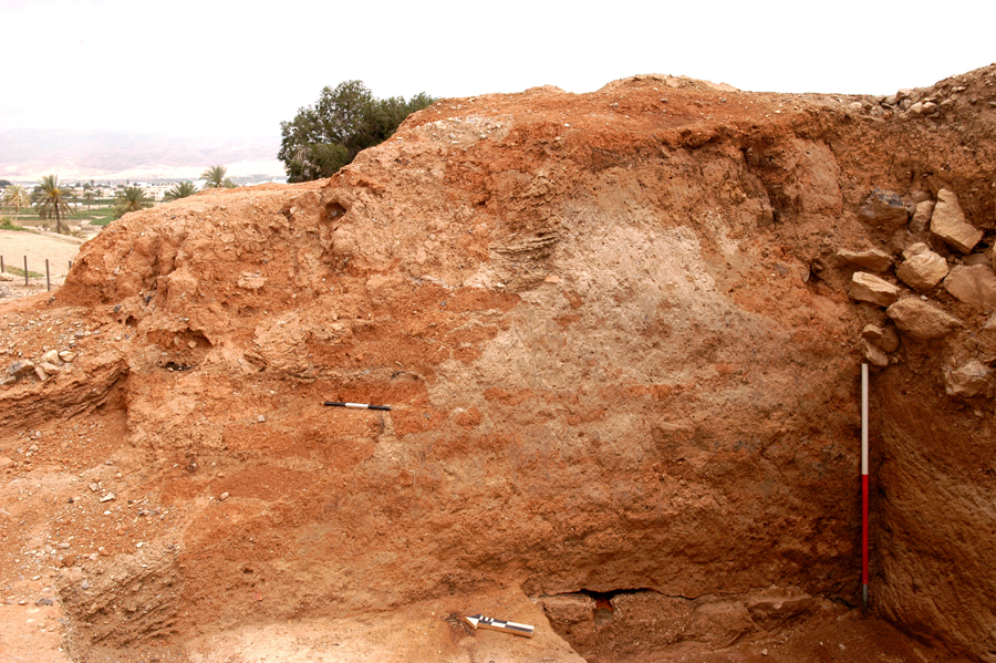
In the nearby Area B-West, extending across the EB III double line of fortifications at the southwest corner of the city (Marchetti - Nigro eds 1998, 81-94), the outer western face of the EB IIIA main Inner Wall was exposed, by digging within a blind room in between it and the Outer Wall (figs. 13-14). Such chamber was filled, in as many other along the south-western corner of the city (visible respectively on both sides of Kenyon's Trench III [Kenyon 1981, 209-213, pl. 273], and in the northern section of Garstang's site "d" [Garstang 1931, pl. I]), with clayish sandy marl, previously erroneously considered white ash by the two British archaeologists due to charcoal fragments present in it, deriving from the city-wall burnt structure (Nigro - Taha eds 2006, 9, fig. 8). The latter was found at a distinct higher elevation in Area B-West in respect of that it exhibits in Trench III, thus demonstrating that the EB III city arose on a slope from west to east where it reached the lowest elevation around the Spring. A close examination of the EB IIIA main Inner Wall showed, in the preserved section brought to light, the burnt remains of reeds and wooden beams inserted into the massive mud-brick structure (fig. 15), up to 4.0 m wide and 8.0 m high, so to ensure air circulation for humidity absorbing, and structural linkage of the wall parts. Moreover, on the inner side of the wall, a regular row of protruding beams may indicate a balcony running along the structure.
5. Area Q: the EB IIIA inner city-wall and postern
A new excavation area was opened on the top of the tell on its western side looking Jebel Quruntul, called Area Q (fig. 1), just south of Kenyon's Trench I and Site D (Kenyon 1981, 6-113). Four squares were excavated on the north-south axis ("Aq + Ar" squares columns in the grid), exposing, under a 1.5 m thick dump filling, the EB IIIA main Inner Wall, here preserved with two superimposed courses of stone foundations and two-to-four courses of mud-brick superstructure. Roughly at the middle of the 20 m-long excavated stretch of the wall, a 1.0 m-wide interruption was discovered, which proved to be a postern, successively closed on the western side (fig. 16). Such a passageway introduced in the blind room in between the Inner and Outer City-Walls, which presumably was used as storeroom and path along the fortification system.
6. Area F: the EB II-III domestic quarter
The reappraisal of exploration on the northern plateau of the tell (already excavated by previous expeditions: Sellin - Watzinger 1913, 36-38, fig. 17, pls. I-II; Garstang et al. 1935; 1936; Kenyon 1981, 309-338 [Squares EIII-IV]) was aimed at the investigation of a domestic quarter of the ancient city during the Early Bronze Age, from the earliest settlement of circular huts in EB I (3300-3000 BC; Nigro 2005) to the gradual transformation of the urban layout on both sides of a main street in EB II-III (3000-2350 BC; Marchetti - Nigro eds 2000, 15-120; Nigro - Taha eds 2006, 5-6, 10-17).
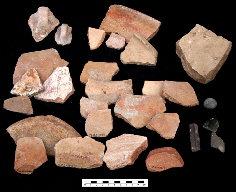
In view of tourist presentation of the Area, an overall restoration workshop with traditional mud-brick technique was carried out in House L.305, while soundings were excavated within other domestic units (fig. 17). Several food producing and storage installations were brought to light in these houses with stratified finds, illustrating typical domestic activities during EB II-III. Especially noteworthy is the finding of balance weights (fig. 18) indicating the Jerichoan shekel (7.8 grams) used for exchange of metal (gold, silver and copper) items, as well as pottery (including the renown Khirbet Kerak Ware and Abydos Ware, respectively in EB III and EB II strata; fig. 19) and flint tools (Cananean blades).
7. Kenyon's Trench I: reappraisal, restoration and musealization of prehistoric Jericho
A strategic issue of the renewed expedition to Tell es-Sultan is the recover, restoration and tourist presentation of Neolithic remains in Kenyon's Trench I. Such a 15 m deep and 70 m long cut, marking the western side of the tell, belongs to the history of world archaeology and, in the meantime, revealed an imposing monument of Pre-Pottery Neolithic Period (8500-6000 BC): the PPNA stone Tower (Kenyon 1981, 18-43, pls. 5-11, 203-212). A preliminary survey of the actual situation of Trench I was carried out during this season (fig. 20), in order to plan systematic restoration works at the PPNA round Tower and selected excavations aimed at preservation and presentation of Neolithic Jericho to the public.
8. Restorations and tourist valorization: fences, paths, explanatory panels
Restoration works were carried out in three Areas (A, B, and F) with the aim of preserving respectively the huge MB I-II Tower A1 in Area A, EB III Building B1 in Area B, and EB III House L.305 in Area F. As regards Tower A1, its stone foundations were restored with antique-like mortar (fig. 5), in order to provide the massive mud-brick superstructure with a solid basement (in the following years also the superstructure will be, of course, restored). Building B1 was completely refurbished with the traditional local technique for earthen architecture (fig. 4), including courses of new mud-bricks laid to protect old structures and mud plaster, which covers all walls. The same technique was adopted in Area F for House L.305 (fig. 17).
Important operations were devoted to site presentation and visit. All tourist paths were refurbished according to the proposed tour of the site with arrows indicating it. New fences were placed for delimitating excavation areas and paths (fig. 3). Explanatory panels, written in English and Arabic, were set up in all Areas, illustrating with texts and images monuments and finds (fig. 2). Also the shelter on top of the site, and the entrance gate were repaired and repainted.
9. Conclusions
The fifth season of excavations and restorations at Tell es-Sultan in Palestine significantly improved our knowledge of the ancient city of Jericho, and, especially, of its formidable defensive systems both in the Early Bronze and in the Middle Bronze Age. Fortification works were brought to light, studied and restored (Areas A and E), showing how defence was a strategic issue in the pre-classical Jerichoan society. Also domestic quarters were explored and restored (Area F), as well as the deep Trench I on the western side of the tell, which conceals unique prehistoric monuments, like the Pre-Pottery Neolithic round Tower, the earliest extra-familiar monument erected by a human community.
Site rehabilitation through the complete re-installation of fences, refurbishing of tourist paths and setting of explanatory panels (figs. 2-3) made readable the archaeological site to the general visitor, marking the first step towards the valorization of an outstanding major cultural resource in the Palestinian Territories: the site of Tell es-Sultan.
References
Garstang, J.
1931 "The Walls of Jericho. The Marston-Melchett Expedition of 1931", in Palestine Exploration Fund. Quarterly Statement 63 (1931), pp. 186-196.
Garstang, J. - Garstang, J.B.E.
1948 The Story of Jericho, London 1948.
Garstang, J. et al.
1935 "Jericho: City and Necropolis (Fifth Report)", in Liverpool Annals of Archaeology and Anthropology 22 (1935), pp. 143-184.
1936 "Jericho: City and Necropolis (Report for the Sixth and Concluding Season, 1936)", in Liverpool Annals of Archaeology and Anthropology 23 (1936), pp. 67-100.
Kenyon, K.M.
1957 Digging Up Jericho, London 1957.
1981 Excavations at Jericho. Volume Three. The Architecture and Stratigraphy of the Tell, London 1981.
1993 "Jericho. Tell es-Sultan", in E. Stern (ed.), The New Encyclopedia of Archaeological Excavations in the Holy Land, Vol. 3, Jerusalem 1993, pp. 674-681.
Marchetti, N. - Nigro, L. (eds)
1998 Scavi a Gerico, 1997. Relazione preliminare sulla prima campagna di scavi e prospezioni archeologiche a Tell es-Sultan, Palestina (= Quaderni di Gerico 1), Roma 1998.
2000 Excavations at Jericho, 1998. Preliminary Report on the Second Season of Excavations and Surveys at Tell es-Sultan, Palestine (= Quaderni di Gerico 2), Roma 2000.
Marchetti, N. - Nigro, L. - Taha, H.
2000 "Preliminary Report on the Second Season of Excavations of the Italian-Palestinian Expedition at Tell es-Sultan/Jericho, 1998", in P. Matthiae, A. Enea, L. Peyronel, F. Pinnock (eds), Proceedings of the First International Congress on the Archaeology of the Ancient Near East, Rome, May 18th-23rd 1998, Roma 2000, pp. 869-901.
Marchetti, N. - Nigro, L. - Yasin, J. - Ghayada, M.
2000 "Third Season of Excavations of the Italian-Palestinian Expedition at Tell es-Sultan/Jericho, October-November 1999", in Orient Express 2000/4, pp. 82-84.
Nigro, L.
1999 "Gerico: le origini della città in Palestina. Caratteri generali, sviluppo e crisi della prima urbanizzazione palestinese nel III millennio a.C.: il caso di Tell es-Sultan, antica Gerico", in Rendiconti della Pontificia Accademia Romana di Archeologia 69 (1999), pp. 187-218.
2005 Tell es-Sultan/Gerico alle soglie della prima urbanizzazione: il villaggio e la necropoli del Bronzo Antico I (3300-3000 a.C.) (= Rome "La Sapienza" Studies on the Archaeology of Palesatine &Transjordan;, 1), Rome 2005.
L. Nigro - H. Taha (eds)
2006 Tell es-Sultan/Jericho in the Context of the Jordan Valley: Site Management, Conservation and Sustainable Development. Proceedings of the International Workshop Held in Ariha 7th - 11th February 2005 by the Palestinian Department of Antiquities and Cultural Heritage - Ministry of Tourism and Antiquities, UNESCO Office - Ramallah, Rome "La Sapienza" University (= Rome «La Sapienza» Studies on the Archaeology of Palestine & Transjordan, 2), Rome 2006.
Sellin, E. - Watzinger, C.
1913 Jericho. Die Ergebnisse der Ausgrabungen (= Wissenschaftliche Veröffentlichung der Deutschen Orient-Gesellschaft 22), Leipzig 1913.
©Copyright 2015 Rome "Sapienza" Expedition to Palestine & Jordan
Design by: Michele De Marco © | Anno 2015